Browsed by
Tag: weather routing

An Iridium Go for West to East

An Iridium Go for West to East

On our crossing from East to West, we had a Garmin InReach for both tracking, weather routing (use Fast Seas), and satellite communication with the outside world.

For the crossing East to West this was a great solution for us. Nice and cheap (comparatively), and provided us with enough information for what should always be a rather uneventful crossing due to the trade winds present in the area.

For the crossing West to East, you are much more likely to be affected by low-pressure systems flicking off Norther America, progressing across the Atlantic past Bermuda toward the Azores, before then heading a bit further north over the UK and Europe.

We purchased the Iridium secondhand from Vela who recently sold their boat in the BVIs before flying home, and it now lives “permanently” on the back wall of our Navigation table.

The setup came with an external antenna which is also “permanently” mounted outside near our port solar panel, with the cable routed into the boat using the same route as the solar panel.

The key difference between the Garmin Inreach and Iridium Go for us is the amount of “data” that you can receive and transmit and also the format.

The Garmin Inreach only allows you to send and receive short SMS-like messages (though you can email from the InReach, they are still SMS lengthed).

This means weather retrieval and weather routing can be a bit more of a pain, sending text instructions and receiving multiple test messages back telling you where you should maybe go and what the weather may be if you are there at the right time. It’s very hard to get a big picture from this though.

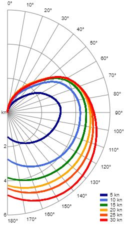
With Iridium it allows us to download Grib files for detailed weather information across a whole area, but also we can choose to pay for and use Predict Wind, which we will be doing for this crossing.

In comparison to the messages above from Fast Seas, the Predict Wind app can work directly with the Iridium Go, providing all of the routings and weather information in an easy to read display on your phone.

It’s all certainly more $$$, but should make the crossing a little easier to plan and we go.

Let’s see what we think about it all when we reach the other side!

Owners Group Reply: Polar File for weather routing

Owners Group Reply: Polar File for weather routing

Has anyone managed to put together a realistic ‘polar file’ for the Nicholson 38? It enables one to interact with weather routing software like Fastseas etc. Any info appreciated, thanks

Czarina Blue

A bit of a long post and reply, but I hope some folks find it useful :).

A while back we tried looking at some of our sailing data to try to create a custom polar but struggled.

For our last few trips, we have used Fast Seas with one of the default polars by just setting some variables.

  • Sailing Vessel
  • Performance Adjustment 70%
  • Start Motoring When Speed Falls Below 2
  • Motoring Speed 4
  • Vessel Waterline Length (LWL) 36.2
  • Closest Point of Sail (True Wind Angle) 60

The polar looks something like this.

TWA\TWS; 0; 5; 10; 15; 20; 25; 30
0; 0.0; 0.0; 0.0; 0.0; 0.0; 0.0; 0.0
40; 0.0; 1.4; 2.5; 2.9; 3.0; 3.0; 2.9
60; 0.0; 3.0; 4.7; 5.2; 5.3; 5.4; 5.4
90; 0.0; 4.2; 5.7; 6.1; 6.4; 6.6; 6.8
135; 0.0; 3.2; 5.2; 6.0; 6.6; 7.1; 7.7
180; 0.0; 1.9; 3.6; 5.1; 5.7; 5.9; 6.4

As I said we have been testing this out with some routes, and had a few learnings.

The main one of those is that if you are fighting against swell, or “larger” waves and chop everything becomes less accurate

Plymouth to Falmouth

This was up wind all of the way with a single tack part way along as the wind changed slightly.
We were sailing on our closest point of sail the whole way, so 60 degrees for the conditions we were in is pretty accurate. This was 1m swell from the west and 15-25 knts generally from the west.
With less swell I imagine we could get closer to the wind that 60 degrees.

The route planned was 12h17m and our track for the routed part was 13h, so pretty close

On this screenshot, you can also see 2 other waypoints (blue pins). These were the tacking points for 2 other polars.
The right most of these was our custom polar that we made a while back, this it turns out would have been too pessimistic.
The leftmost of these was with a 45 degrees as the closest point of sail.

Penzance to the Isles of Scilly

Routed time 8.5h, Tracked time 8 hours
We cheated slightly here between points 5 and 6 on the route where we found ourselves with no wind and we motored around the corner a little to find it again. This might explain why we beat the routed time.

Isles of Scilly to Brest

We had a pretty simple route for this which was mainly downwind.

We ended up hacking to do the odd gybe and gull-winged at points.

The route here was 1d5h and our track along the route was actually only 24h.

At a guess, this was due to the following 1-1.6m swell the whole way pushing us a bit faster. Max land speed here for us was actually 11knts